PostGIS definitions that are needed in MobilityDB but are not exported in PostGIS headers. More...
Include dependency graph for postgis.h:
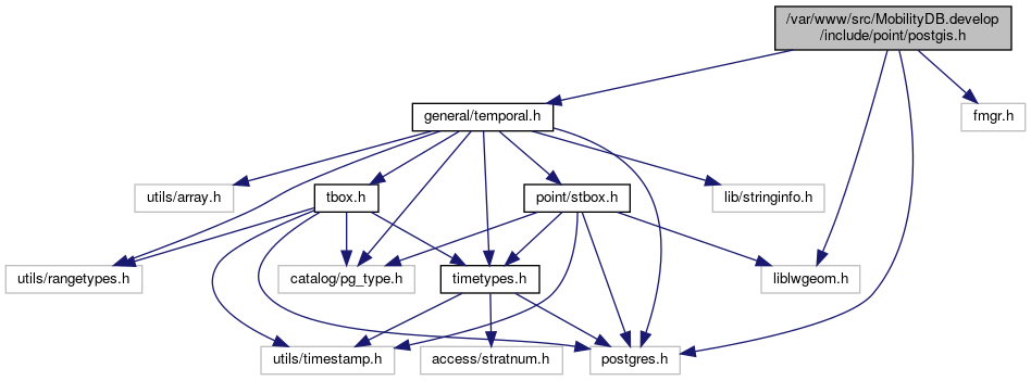
This graph shows which files directly or indirectly include this file:

Go to the source code of this file.
Data Structures | |
| struct | GEOGRAPHIC_POINT |
| Point in spherical coordinates on the world. More... | |
| struct | GEOGRAPHIC_EDGE |
| Two-point great circle segment from a to b. More... | |
| struct | DISTPTS |
| struct | DISTPTS3D |
| struct | VECTOR3D |
| struct | circ_node |
| struct | gridspec_t |
| Snap-to-grid Support. More... | |
Macros | |
| #define | deg2rad(d) (M_PI * (d) / 180.0) |
| Conversion functions. More... | |
| #define | rad2deg(r) (180.0 * (r) / M_PI) |
| #define | POSTGIS_FREE_IF_COPY_P(ptrsrc, ptrori) |
| #define | DIST_MAX -1 |
| #define | DIST_MIN 1 |
| #define | DOT(u, v) ((u).x * (v).x + (u).y * (v).y + (u).z * (v).z) |
| #define | VECTORLENGTH(v) sqrt(((v).x * (v).x) + ((v).y * (v).y) + ((v).z * (v).z)) |
| #define | PIR_NO_INTERACT 0x00 |
| Bitmask elements for edge_intersects() return value. More... | |
| #define | PIR_INTERSECTS 0x01 |
| #define | PIR_COLINEAR 0x02 |
| #define | PIR_A_TOUCH_RIGHT 0x04 |
| #define | PIR_A_TOUCH_LEFT 0x08 |
| #define | PIR_B_TOUCH_RIGHT 0x10 |
| #define | PIR_B_TOUCH_LEFT 0x20 |
| #define | FP_TOLERANCE 1e-12 |
| Floating point comparators. More... | |
| #define | FP_IS_ZERO(A) (fabs(A) <= FP_TOLERANCE) |
| #define | FP_MAX(A, B) (((A) > (B)) ? (A) : (B)) |
| #define | FP_MIN(A, B) (((A) < (B)) ? (A) : (B)) |
| #define | FP_ABS(a) ((a) < (0) ? -(a) : (a)) |
| #define | FP_EQUALS(A, B) (fabs((A)-(B)) <= FP_TOLERANCE) |
| #define | FP_NEQUALS(A, B) (fabs((A)-(B)) > FP_TOLERANCE) |
| #define | FP_LT(A, B) (((A) + FP_TOLERANCE) < (B)) |
| #define | FP_LTEQ(A, B) (((A) - FP_TOLERANCE) <= (B)) |
| #define | FP_GT(A, B) (((A) - FP_TOLERANCE) > (B)) |
| #define | FP_GTEQ(A, B) (((A) + FP_TOLERANCE) >= (B)) |
| #define | FP_CONTAINS_TOP(A, X, B) (FP_LT(A, X) && FP_LTEQ(X, B)) |
| #define | FP_CONTAINS_BOTTOM(A, X, B) (FP_LTEQ(A, X) && FP_LT(X, B)) |
| #define | FP_CONTAINS_INCL(A, X, B) (FP_LTEQ(A, X) && FP_LTEQ(X, B)) |
| #define | FP_CONTAINS_EXCL(A, X, B) (FP_LT(A, X) && FP_LT(X, B)) |
| #define | FP_CONTAINS(A, X, B) FP_CONTAINS_EXCL(A, X, B) |
| #define | PG_GETARG_GSERIALIZED_P(varno) ((GSERIALIZED *)PG_DETOAST_DATUM(PG_GETARG_DATUM(varno))) |
| #define | PG_GETARG_GSERIALIZED_P_COPY(varno) ((GSERIALIZED *)PG_DETOAST_DATUM_COPY(PG_GETARG_DATUM(varno))) |
Typedefs | |
| typedef struct circ_node | CIRC_NODE |
| typedef struct gridspec_t | gridspec |
| Snap-to-grid Support. More... | |
Functions | |
| int | spheroid_init_from_srid (FunctionCallInfo fcinfo, int srid, SPHEROID *s) |
| double | ptarray_length_spheroid (const POINTARRAY *pa, const SPHEROID *s) |
| int | lwline_is_empty (const LWLINE *line) |
| void | geographic_point_init (double lon, double lat, GEOGRAPHIC_POINT *g) |
| double | sphere_distance (const GEOGRAPHIC_POINT *s, const GEOGRAPHIC_POINT *e) |
| void | geog2cart (const GEOGRAPHIC_POINT *g, POINT3D *p) |
| void | cart2geog (const POINT3D *p, GEOGRAPHIC_POINT *g) |
| void | normalize (POINT3D *p) |
| int | edge_contains_coplanar_point (const GEOGRAPHIC_EDGE *e, const GEOGRAPHIC_POINT *p) |
| double | edge_distance_to_point (const GEOGRAPHIC_EDGE *e, const GEOGRAPHIC_POINT *gp, GEOGRAPHIC_POINT *closest) |
| uint32_t | edge_intersects (const POINT3D *A1, const POINT3D *A2, const POINT3D *B1, const POINT3D *B2) |
| int | edge_intersection (const GEOGRAPHIC_EDGE *e1, const GEOGRAPHIC_EDGE *e2, GEOGRAPHIC_POINT *g) |
| double | edge_distance_to_edge (const GEOGRAPHIC_EDGE *e1, const GEOGRAPHIC_EDGE *e2, GEOGRAPHIC_POINT *closest1, GEOGRAPHIC_POINT *closest2) |
| int | lw_dist2d_recursive (const LWGEOM *lw1, const LWGEOM *lw2, DISTPTS *dl) |
| int | lw_dist2d_seg_seg (const POINT2D *A, const POINT2D *B, const POINT2D *C, const POINT2D *D, DISTPTS *dl) |
| int | lw_dist3d_pt_pt (POINT3DZ *p1, POINT3DZ *p2, DISTPTS3D *dl) |
| int | lw_dist3d_pt_seg (POINT3DZ *p, POINT3DZ *A, POINT3DZ *B, DISTPTS3D *dl) |
| int | lw_dist3d_recursive (const LWGEOM *lwg1, const LWGEOM *lwg2, DISTPTS3D *dl) |
| int | lw_dist3d_seg_seg (POINT3DZ *s1p1, POINT3DZ *s1p2, POINT3DZ *s2p1, POINT3DZ *s2p2, DISTPTS3D *dl) |
| double | spheroid_distance (const GEOGRAPHIC_POINT *a, const GEOGRAPHIC_POINT *b, const SPHEROID *spheroid) |
| int | geographic_point_equals (const GEOGRAPHIC_POINT *g1, const GEOGRAPHIC_POINT *g2) |
| CIRC_NODE * | lwgeom_calculate_circ_tree (const LWGEOM *lwgeom) |
| void | circ_tree_free (CIRC_NODE *node) |
| int | p4d_same (const POINT4D *p1, const POINT4D *p2) |
| int | p3d_same (const POINT3D *p1, const POINT3D *p2) |
| int | p2d_same (const POINT2D *p1, const POINT2D *p2) |
| void | srid_is_latlong (FunctionCallInfo fcinfo, int srid) |
| int | clamp_srid (int srid) |
| int | getSRIDbySRS (FunctionCallInfo fcinfo, const char *srs) |
| char * | getSRSbySRID (FunctionCallInfo fcinfo, int32_t srid, bool short_crs) |
| int | lwprint_double (double d, int maxdd, char *buf, size_t bufsize) |
| char | getMachineEndian (void) |
| char | lwpoint_same (const LWPOINT *p1, const LWPOINT *p2) |
| LWPOINT * | lwpoint_clone (const LWPOINT *lwgeom) |
| Datum | transform (PG_FUNCTION_ARGS) |
| Datum | buffer (PG_FUNCTION_ARGS) |
| Datum | centroid (PG_FUNCTION_ARGS) |
| Datum | geography_from_geometry (PG_FUNCTION_ARGS) |
| Datum | geometry_from_geography (PG_FUNCTION_ARGS) |
| Datum | boundary (PG_FUNCTION_ARGS) |
| Datum | contains (PG_FUNCTION_ARGS) |
| Datum | containsproperly (PG_FUNCTION_ARGS) |
| Datum | covers (PG_FUNCTION_ARGS) |
| Datum | coveredby (PG_FUNCTION_ARGS) |
| Datum | crosses (PG_FUNCTION_ARGS) |
| Datum | disjoint (PG_FUNCTION_ARGS) |
| Datum | issimple (PG_FUNCTION_ARGS) |
| Datum | overlaps (PG_FUNCTION_ARGS) |
| Datum | pgis_union_geometry_array (PG_FUNCTION_ARGS) |
| Datum | relate_full (PG_FUNCTION_ARGS) |
| Datum | relate_pattern (PG_FUNCTION_ARGS) |
| Datum | touches (PG_FUNCTION_ARGS) |
| Datum | within (PG_FUNCTION_ARGS) |
| Datum | ST_Equals (PG_FUNCTION_ARGS) |
| Datum | distance (PG_FUNCTION_ARGS) |
| Datum | distance3d (PG_FUNCTION_ARGS) |
| Datum | intersection (PG_FUNCTION_ARGS) |
| Datum | intersects (PG_FUNCTION_ARGS) |
| Datum | intersects3d (PG_FUNCTION_ARGS) |
| Datum | BOX2D_to_LWGEOM (PG_FUNCTION_ARGS) |
| Datum | BOX3D_to_LWGEOM (PG_FUNCTION_ARGS) |
| Datum | LWGEOM_addpoint (PG_FUNCTION_ARGS) |
| Datum | LWGEOM_azimuth (PG_FUNCTION_ARGS) |
| Datum | LWGEOM_closestpoint (PG_FUNCTION_ARGS) |
| Datum | LWGEOM_closestpoint3d (PG_FUNCTION_ARGS) |
| Datum | LWGEOM_collect_garray (PG_FUNCTION_ARGS) |
| Datum | LWGEOM_dwithin (PG_FUNCTION_ARGS) |
| Datum | LWGEOM_dwithin3d (PG_FUNCTION_ARGS) |
| Datum | LWGEOM_geometryn_collection (PG_FUNCTION_ARGS) |
| Datum | LWGEOM_get_srid (PG_FUNCTION_ARGS) |
| Datum | LWGEOM_set_srid (PG_FUNCTION_ARGS) |
| Datum | LWGEOM_isempty (PG_FUNCTION_ARGS) |
| Datum | LWGEOM_length_linestring (PG_FUNCTION_ARGS) |
| Datum | LWGEOM_line_locate_point (PG_FUNCTION_ARGS) |
| Datum | LWGEOM_line_interpolate_point (PG_FUNCTION_ARGS) |
| Datum | LWGEOM_line_substring (PG_FUNCTION_ARGS) |
| Datum | LWGEOM_makepoint (PG_FUNCTION_ARGS) |
| Datum | LWGEOM_numgeometries_collection (PG_FUNCTION_ARGS) |
| Datum | LWGEOM_numpoints_linestring (PG_FUNCTION_ARGS) |
| Datum | LWGEOM_pointn_linestring (PG_FUNCTION_ARGS) |
| Datum | LWGEOM_reverse (PG_FUNCTION_ARGS) |
| Datum | LWGEOM_setpoint_linestring (PG_FUNCTION_ARGS) |
| Datum | LWGEOM_shortestline2d (PG_FUNCTION_ARGS) |
| Datum | LWGEOM_shortestline3d (PG_FUNCTION_ARGS) |
| Datum | lwgeom_eq (PG_FUNCTION_ARGS) |
| Datum | lwgeom_lt (PG_FUNCTION_ARGS) |
| Datum | lwgeom_hash (PG_FUNCTION_ARGS) |
| Datum | geography_covers (PG_FUNCTION_ARGS) |
| Datum | geography_length (PG_FUNCTION_ARGS) |
| Datum | geography_dwithin (PG_FUNCTION_ARGS) |
| Datum | geography_distance (PG_FUNCTION_ARGS) |
| Datum | geography_azimuth (PG_FUNCTION_ARGS) |
| Datum | geography_bestsrid (PG_FUNCTION_ARGS) |
| Datum | geography_eq (PG_FUNCTION_ARGS) |
| Datum | geography_lt (PG_FUNCTION_ARGS) |
Detailed Description
PostGIS definitions that are needed in MobilityDB but are not exported in PostGIS headers.